
Researchers have created a map of oceanic “dead zones” that existed during the Pliocene epoch, when the Earth’s climate was two to three degrees warmer than it is now.
Researchers have created a map of oceanic “dead zones” that existed during the Pliocene epoch, when the Earth’s climate was two to three degrees warmer than it is now. The work could provide a glimpse into the locations and potential impacts of future low oxygen zones in a warmer Earth’s oceans.
Oxygen minimum zones, or OMZs, are areas in the ocean where oxygen levels in the mid-waters (from 100 to 1000 meters below the surface) are too low to support most marine life. These dead zones play an important role in the ocean’s overall health.
“OMZs are very important for geochemical cycling in the ocean,” says Catherine Davis, assistant professor of marine, earth and atmospheric sciences at North Carolina State University and corresponding author of the research. “They occur in areas where sunlight and atmospheric oxygen don’t reach. Their locations dictate where carbon and nitrogen (an essential nutrient for all life on Earth) are available in the ocean – so they’re important drivers of nutrient cycles.”
Being able to predict the location of OMZs is important not only for understanding nutrient cycling, but also because of their effects on marine life. Oceanic dead zones restrict the range of animals to the shallow surface ocean where oxygen is more plentiful.
Read more at North Carolina State University
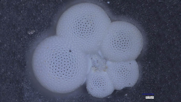
Image: Globorataloides hexagonus shell recovered from a deep-sea sediment core in the tropical Pacific ocean. (Image Credit: Catherine Davis)


