
December was an active month for NOAA’s National Water Level Observation Network (NWLON). A staggering eight stations observed all-time high water levels — some of which broke records in place for 40 years.
December was an active month for NOAA’s National Water Level Observation Network (NWLON). A staggering eight stations observed all-time high water levels — some of which broke records in place for 40 years. The Pacific Northwest was the most affected region, with four locations in the state of Washington observing their highest-ever water levels on record.
In addition to Washington’s stations, new water level records were set at Quonset Point, Rhode Island, and two water level stations in Alaska: Sand Point and King Cove.
Leading contributors: high tide flooding and winter storms.
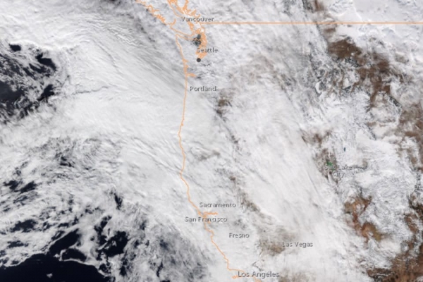
High tide flooding happens when higher than normal high tides, such as a perigean spring tide, combine with sea level rise and, in some areas, coastal subsidence. While coastal flooding does not always occur during a perigean spring tide, it can increase the likelihood of minor high tide flooding in low-lying areas. This type of flooding, frequently seen during high tide and extreme weather events, exceeds established flood impact thresholds. Even minor high tide flooding events can result in inundated roads and backed up sewers. Weather conditions often compound this flooding, which can cause even more damage. This happened on December 27, 2022, when a strong winter storm hit the Pacific Northwest while tides were still above normal following the perigean spring tide.
Read more at: NOAA
A winter storm as seen from NOAA's GOES satellite on December 29, 2022, in the Pacific Northwest. The storm coincided with higher than normal high tides, resulting in high tide flooding across Washington. (Photo Credit: NOAA)


