
When the rigid plates that make up the Earth’s lithosphere brush against one another, they often form visible boundaries, known as faults, on the planet’s surface. Strike-slip faults, such as the San Andreas Fault in California or the Denali Fault in Alaska, are among the most well-known and capable of seriously powerful seismic activity.
When the rigid plates that make up the Earth’s lithosphere brush against one another, they often form visible boundaries, known as faults, on the planet’s surface. Strike-slip faults, such as the San Andreas Fault in California or the Denali Fault in Alaska, are among the most well-known and capable of seriously powerful seismic activity.
Studying these faults can help geoscientists not only better understand the process of plate tectonics, which helped form the planet’s continents and mountains, but also better model their earthquake hazards. The problem is that most studies on these types of faults are (quite literally) shallow, looking only at the upper layer of the Earth’s crust where the faults form.
New research led by Brown University seismologists digs deeper into the Earth, analyzing how the part of the fault that’s near the surface connects to the base of the tectonic plate in the mantle. The scientists found that changes in how thick the plate is and how strong it is deep into the Earth play a key role in the location of Alaska’s Denali Fault, one of the world’s major strike-slip faults.
Read more at Brown University
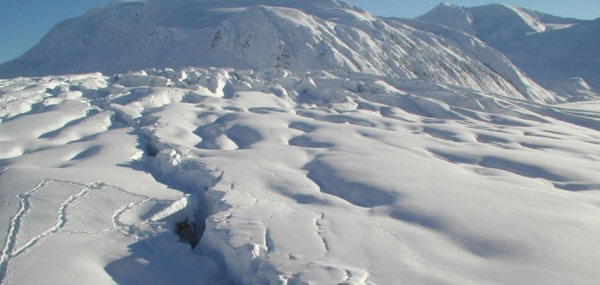
Photo: Denali fault trace cutting through Gakona Glacier, just after the 2002 earthquake. Tracks are from where geologists measured the fault offset. Photo Credit: Peter Haeussler/U.S. Geological Survey. Licensed under Public Domain.


