
For more than a month, Tropical Cyclone Freddy has cast about in the Indian Ocean, bringing powerful winds and downpours to anything in its long and wandering path.
For more than a month, Tropical Cyclone Freddy has cast about in the Indian Ocean, bringing powerful winds and downpours to anything in its long and wandering path.
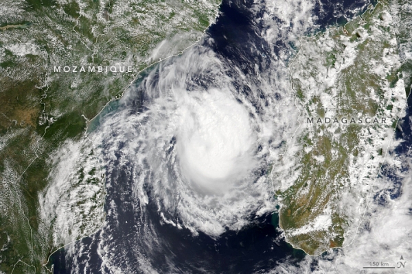
The storm first developed off the North Australian coast on February 6, 2023, and then tracked across the entire Indian Ocean before striking the east coast of Madagascar on February 21, 2023. It then crossed the Mozambique Channel and made landfall in Mozambique’s Inhambane province near Vilankulo, where it stalled and dropped a huge amount of rain before doubling back and nearly hit the west coast of Madagascar again. As of March 8, 2023, the weakening storm was following a northwesterly track toward a likely second landfall in Mozambique—this time in the Zambezia province.
The Visible Infrared Imaging Radiometer Suite (VIIRS) on the NOAA-20 satellite acquired this image of the storm at 1:10 p.m. local time (11:10 Universal Time) on March 8, 2023. An infusion of dry air and the storm’s position over relatively cool waters meant Freddy was weakening and the eye had broken down when the image was acquired. However, forecasters at the Joint Typhoon Warning Center warned that Freddy will likely still hit Mozambique with sustained winds of 139 kilometers (86 miles) per hour, making it the equivalent of a category 1 hurricane.
Read more at: NASA Earth Observatory
Photo Credit: Lauren Dauphin from NASA Earth Observatory


