
Scientists at Flinders University have used sub-surface imaging and aerial surveys to see through floodplains in the Red Lily Lagoon area of West Arnhem Land.
Scientists at Flinders University have used sub-surface imaging and aerial surveys to see through floodplains in the Red Lily Lagoon area of West Arnhem Land.
These ground-breaking methods showed how this important landscape in the Northern Territory was altered as sea levels rose about 8,000 years ago.
Their discovery shows that the ocean had reached this, now inland region, which has important implications for understanding the archaeological record of Madjedbebe—the oldest archaeological site in Australia.
The findings also provide a new way to understand the rock art in the region, which is recognised globally for its significance and distinctive style.
Read more at Flinders University
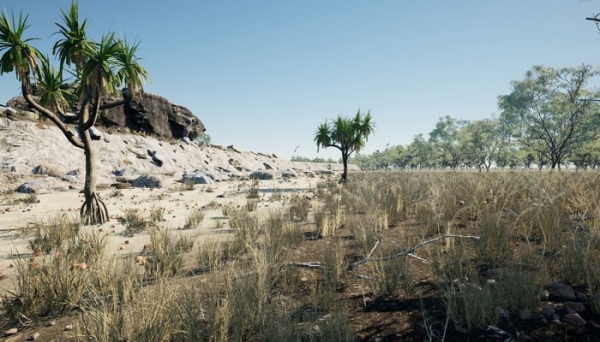
Image: Red Lily Lagoon Pleistocene (Ice age) 9,000 years ago visualisation. Dr Jarrad Knowlessar, Flinders University Research Associate. (Credit: Dr Jarrad Knowlessar, Flinders University Research Associate)


