
Satellite imagery shows the vast extent of wildfires in Canada and the lingering veil of smoke over the Eastern U.S.
Satellite imagery shows the vast extent of wildfires in Canada and the lingering veil of smoke over the Eastern U.S.
A heavy haze grounded flights and spurred “Code Purple” air quality alerts in eastern cities this week as wildfires gave rise to record levels of air pollution. While air quality is slowly improving, smoky conditions persist, as shown in satellite images from Colorado State University’s Cooperative Institute for Research in the Atmosphere and the National Oceanic and Atmospheric Administration.
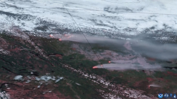
Close to 430 wildfires are burning across Canada, including more than 140 in Quebec, and most fires remain out of control. Satellite images show blazes erupting in Quebec this week, sending smoke south toward the U.S.
Read more at Yale Environment 360
Image: Wildfires burn in Alberta and British Columbia, June 7, 2023. CIRA / NOAA


