
On an overcast morning this past spring, Gegham Muradyan searches for signs of water trickling through the dry soils of Armenia’s Ararat Valley.
On an overcast morning this past spring, Gegham Muradyan searches for signs of water trickling through the dry soils of Armenia’s Ararat Valley. In an opening between two stone houses in the village of Dalar, some 15 miles southwest of Yerevan, the nation’s capital, he finds a single pipe protruding from knots of weeds.
A hydrometeorologist at Armenia’s Ministry of Environment, Muradyan holds a measuring cup beneath the water flowing from the pipe and notes the time it takes to fill. He does a quick calculation, then records the well discharge rate — an indicator of underground water pressure — in a logbook. Over the past year, the rate has dropped from 850 milliliters per second to 570 milliliters. “That’s very serious for this one,” he says.
For several years, Muradyan and his colleagues have crisscrossed this region to record the depth and velocity of groundwater at wells and boreholes. In 2016, they surveyed more than 2,800 sites — the most comprehensive analysis performed since the early 1980s. Their painstaking work has confirmed that the aquifer has shrunk from more than 32,000 hectares, in 1983, to just over 10,000 hectares. In some parts of the valley, the water table has dropped as much as 49 feet.
Read more at: Yale Environment 360
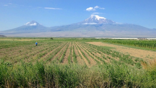
Mount Ararat towers over Armenia's arid Ararat Valley. (Photo Credit: ADALYAN / DREAMSTIME)


