
New research co-led by Simon Fraser University and the University of British Columbia shows that amplified global warming in the Canadian High Arctic drove a profound shift in the structure of a river network carved into a permafrost landscape in only 60 years.
New research co-led by Simon Fraser University and the University of British Columbia shows that amplified global warming in the Canadian High Arctic drove a profound shift in the structure of a river network carved into a permafrost landscape in only 60 years. Documenting a powerful interplay among climate change, the freeze-thaw dynamics of polygonal ground and the delivery of surface water by floods as well as snow and ice melting, the team developed a new view of the physical controls governing the speed and pattern of river channel development in these fragile landscapes.
“One of the key processes we identified in the evolution of stream networks is that their development is influenced by the way water flows through fields of roughly 10-metre-wide polygons, created through the freezing and thawing of the soil in Arctic regions,” says Shawn Chartrand, assistant professor in the School of Environmental Science at Simon Fraser University, and lead author of research published today in Nature Communications. “This influence is also affected by the timing, magnitude and duration of flood events, as well as whether the underlying sediment particle substrates are frozen, or partially frozen.”
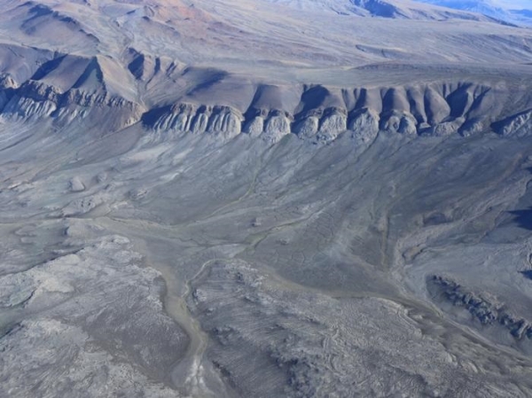
Chartrand is part of an international research team that arrived at the uninhabited island of Axel Heiberg at the start of one of the most intense summer warming events ever recorded. Their field research focused on the island’s Muskox Valley, east of the Muller Ice Cap. Researchers combined air photographs from 1959 with field observations and state-of-the-art Light Detection and Ranging (LiDAR) data they collected in 2019 to understand how the Axel Heiberg Island landscape has evolved over a 60-year period.
Read more at: Simon Fraser University
Polygons and channel networks on the west side of Axel Heiberg Island near Expedition Fjord. (Photo Credit: Shawn Chartrand)


