
Harmful algae can endanger public health and coastal ecosystems and economies.
Harmful algae can endanger public health and coastal ecosystems and economies. Advances in satellite imaging are providing new ways to look at our living ocean.
By the time they were over, a series of massive algal blooms along the west coast of Florida in 2020 would be linked to some 2,000 tons of dead marine life around Tampa Bay. The human costs were stark, too, including a double-digit increase in asthma cases in Sarasota and Pinellas counties, and estimated losses of around $1 billion across economic sectors from tourism to fisheries.
Earth-orbiting satellites have been used for decades to detect algal blooms from space, enabling more frequent observations over broader areas than is possible by directly sampling the water. The most common observing technique relies on the visible spectrum to measure ocean color. However, this approach has been mostly restricted to clear sky conditions.
A recent study, led by scientists at NASA’s Jet Propulsion Laboratory in Southern California, has shown how one space-based instrument called TROPOMI, or TROPOspheric Monitoring Instrument, was able to peer through thin clouds to uncover powerful clues about Karenia brevis (or K. brevis), the microscopic algae responsible for the 2020 blooms. TROPOMI’s enhanced ability to “see” and measure fine wavelengths of light could potentially help federal agencies and local communities better forecast and manage harmful outbreaks. (TROPOMI flies aboard the European Sentinel 5P spacecraft, which was launched in 2017.)
Read more at NASA
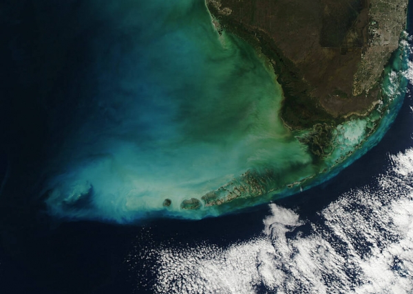
Image: NASA’s MODIS instrument captured this image of the southern tip of Florida curving into a blue-green ocean edged by white clouds. MODIS and a new generation of satellite-based sensors can help environmental managers track noxious algae in the Gulf Coast and beyond. (Credits: NASA)


