
One of the iconic features of drylands is the striking appearance of islands of plants surrounded by bare soil.
One of the iconic features of drylands is the striking appearance of islands of plants surrounded by bare soil. This spatial structure of arid vegetation has long fascinated scientists, but now a new study published in Proceedings of the National Academy of Sciences, has shed new light on why these plants group in this way.
An international team of scientists, including from the University of Birmingham, combined field data from 115 sites around the world, and used mathematical models and remote sensing to build a picture of how the environment impacts the special structure of the plant life.
Dr Juliano Sarmento Cabral, Associate Professor for Biodiversity Modelling and Environmental Change at the University of Birmingham who worked on the study, said: “There are two drivers of the biodiversity crisis that are expected to have catastrophic synergies: land use and climate change. We urgently need to understand how ecosystems respond to a lower humidity and less available water, given the increase of extreme drought events expected under the impending climate crisis, something that the UK has already experienced in 2022 first hand. However, the ability of ecosystems to adequately respond to climate change could be jeopardised if they already suffer from human-caused degradation such as overgrazing, depauperate biodiversity and resource exploitation. We are now able to identify tell-tale signs of both the degradation and the ability to cope with a drying environment.”
Read more at: University of Birmingham
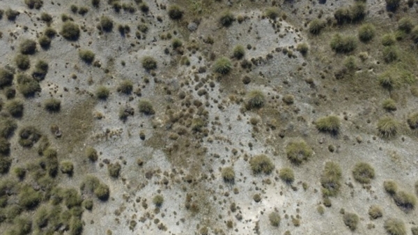
Asemiarid steppe in central Spain (Ciempozuelos). (Photo credit: Miguel Garcia Gomez)


