
An unusually strong winter storm parked over California for several days in early February 2024, dropping a tremendous amount of rain that spurred widespread flash floods and hundreds of mudslides.
An unusually strong winter storm parked over California for several days in early February 2024, dropping a tremendous amount of rain that spurred widespread flash floods and hundreds of mudslides. Much of the rain fell on southern parts of the state, the product of a potent atmospheric river that delivered water vapor to the region from the tropical Pacific.
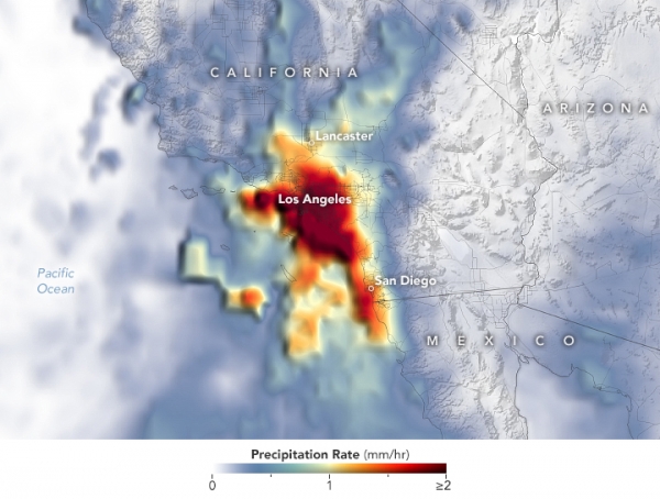
The map above shows a satellite-based estimate of the storm’s average rainfall rates. Data for the map were acquired between the afternoons (local time) of February 4 and February 6. The darkest reds reflect the highest rainfall rates, with the Los Angeles metropolitan area seeing the heaviest rains during this time.
Data for the map are remotely sensed estimates that come from IMERG (Integrated Multi-Satellite Retrievals for GPM), a product of the GPM (Global Precipitation Measurement) mission. Due to the averaging of the satellite data, local rainfall rates may be significantly higher when measured from the ground.
Read more at NASA Earth Observatory
Image: Torrential rain fell on southern parts of the state, the product of an intense atmospheric river. NASA Earth Observatory image by Lauren Dauphin, using IMERG data from the Global Precipitation Mission (GPM) at NASA/GSFC.


