
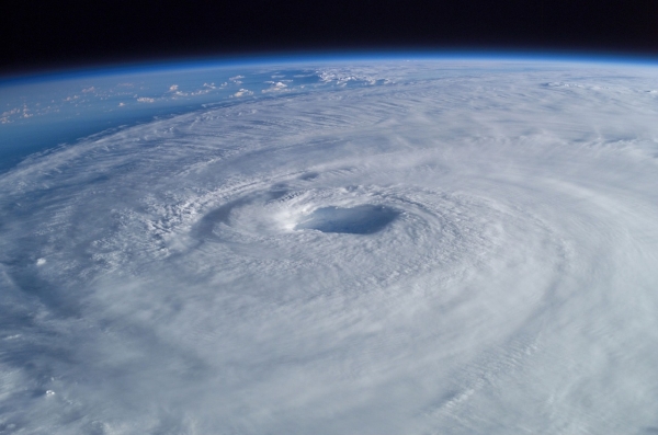
In March 2024, low wind shear in the Mozambique Channel allowed Tropical Cyclone Filipo to strengthen off the coast of southeast Africa.
In March 2024, low wind shear in the Mozambique Channel allowed Tropical Cyclone Filipo to strengthen off the coast of southeast Africa. The MODIS (Moderate Resolution Imaging Spectroradiometer) on NASA’s Terra satellite acquired this image at around 9 a.m. local time (07:00 Universal Time) on March 11, 2024, as the storm neared Mozambique.
Around the time of this image, Filipo carried maximum wind speeds of about 80 kilometers (50 miles) per hour—equivalent to a tropical storm on the Saffir-Simpson wind scale. The storm, centered several hundred kilometers off the south-central coast of Mozambique, was moving southwest and ultimately made landfall on March 12 at about 5 a.m. local time near the coastal town of Inhassoro, according to Météo-France.
Filipo weakened as it moved across land on March 12, but it continued to deliver strong winds and heavy rain in the Inhambane and Gaza provinces. According to ReliefWeb, more than half a million people live in areas considered to be at risk from the storm. Risks included the potential for flooding and damage to crops and infrastructure.
Read more at NASA Earth Observatory
Photo Credit: WikiImages via Pixabay


