
The novel approach to estimating river water storage and discharge also identifies regions marked by ‘fingerprints’ of intense water use.
The novel approach to estimating river water storage and discharge also identifies regions marked by ‘fingerprints’ of intense water use.
A study led by NASA researchers provides new estimates of how much water courses through Earth’s rivers, the rates at which it’s flowing into the ocean, and how much both of those figures have fluctuated over time — crucial information for understanding the planet’s water cycle and managing its freshwater supplies. The results also highlight regions depleted by heavy water use, including the Colorado River basin in the United States, the Amazon basin in South America, and the Orange River basin in southern Africa.
For the study, which was recently published in Nature Geoscience, researchers at NASA’s Jet Propulsion Laboratory in Southern California used a novel methodology that combines stream-gauge measurements with computer models of about 3 million river segments around the world.
Read more at NASA
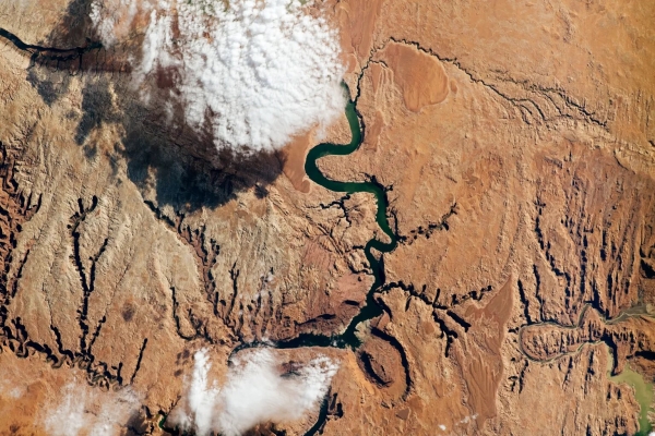
Image: The Colorado River supplies water to more than 40 million people as it snakes through seven U.S. states, including the part of southeastern Utah seen in this photo snapped by an astronaut aboard the International Space Station. The Colorado basin was identified in a NASA-led study as a region experiencing intense human water use. (Credit: NASA)


