
Navigating New York waterways just got a bit easier. NOAA and the New York State Department of Environmental Conservation announced the establishment of the Hudson River Estuary Physical Oceanographic Real-time System (PORTS®).
Navigating New York waterways just got a bit easier. NOAA and the New York State Department of Environmental Conservation announced the establishment of the Hudson River Estuary Physical Oceanographic Real-time System (PORTS®). The system delivers real-time oceanographic and meteorological observations that can improve maritime safety and inform coastal resource management in the region. Commercial mariners, recreational boaters, resource managers, and coastal planners can use the online tool to access real-time water level data from Sleepy Hollow to Troy, New York.
The Hudson River Estuary PORTS® is the second system of its kind in New York — the first being situated 100 miles south that provides data for the New York-New Jersey Harbor PORTS®. The new system currently consists of one water level station at Turkey Point, south of Saugerties, New York, and is part of the New York State Department of Environmental Conservation’s Hudson River National Estuarine Research Reserve. The system will fill critical geographic gaps in the state’s maritime data and expand coverage to include the tidally influenced portions of the Hudson River, north of the Mario M. Cuomo Bridge.
Read More: NOAA
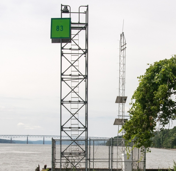
The Hudson River Estuary PORTS® station at Turkey Point, New York in January 2025. It measures and disseminates observations and predictions of water levels, currents, salinity, and meteorological parameters — winds, atmospheric pressure, air and water temperatures — that mariners need to navigate safely. (Photo Credit: Sarah Fernald, NYSDEC)


