
Scientists have launched an interactive global map to show the migratory patterns of more than 100 marine species in an effort to protect at-risk wildlife.
Scientists have launched an interactive global map to show the migratory patterns of more than 100 marine species in an effort to protect at-risk wildlife.
New models were developed by The University of Queensland and Duke University scientists to be part of the Migratory Connectivity in the Ocean (MiCO) database which aims to bridge information gaps for policymakers and conservationists.
Dr Lily Bentley from UQ’s Centre for Biodiversity and Conservation Science said the online tool was the first freely accessible global view of marine migratory connectivity.
“Covering 109 species including birds, mammals, turtles and fish, MiCO brings together thousands of records from more than 1,300 sources to map how marine animals traverse the world's oceans,” Dr Bentley said.
Read more at University of Queensland
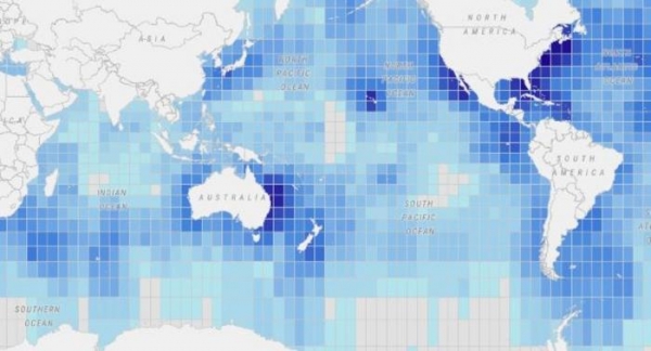
Image: Each square on the MiCO map contains information on the species which move through that part of the ocean. (Credit: UQ)


