
In the early 1800s, pirate Jean Lafitte smuggled goods and slaves through Louisiana’s muddy coastal waters, navigating the bayous, bays, and lakes up to New Orleans.
In the early 1800s, pirate Jean Lafitte smuggled goods and slaves through Louisiana’s muddy coastal waters, navigating the bayous, bays, and lakes up to New Orleans. However, any map he used would likely lead today’s sailors astray. Satellite images show that in the past 40 years alone, Louisiana’s coastal areas have undergone substantial changes.
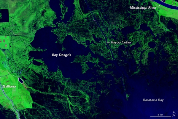
The image pair above shows Bay Dosgris, about 30 miles south of New Orleans, where Lafitte likely passed through with his crew centuries ago. Between 1985 (left) and 2024 (right), much of the wetland surrounding Bay Dosgris has become open water. The images were acquired by the TM (Thematic Mapper) on Landsat 5 and the OLI-2 (Operational Land Imager-2) on Landsat 9, respectively.
The images above and below are false color, in which open water appears dark blue and low-lying areas inundated with water (marsh) appear dark blue-green. Vegetated areas farther inland appear bright green.
Read More: NASA Earth Observatory
Photo Credit: Ross Walter/NASA Earth Observatory


