
A new study examined decades of atmospheric river storms across the West Coast to pinpoint the conditions that lead to catastrophic flooding.
A new study examined decades of atmospheric river storms across the West Coast to pinpoint the conditions that lead to catastrophic flooding.
Atmospheric rivers are responsible for most flooding on the West Coast of the U.S., but also bring much needed moisture to the region. The size of these storms doesn’t always translate to flood risk, however, as other factors on the ground play important roles. Now, a new study helps untangle the other drivers of flooding to help communities and water managers better prepare.
The research, published June 4 in the Journal of Hydrometeorology, analyzed more than 43,000 atmospheric river storms across 122 watersheds on the West Coast between 1980 and 2023. The researchers found that one of the primary driving forces of flooding is wet soils that can’t absorb more water when a storm hits. They showed that flood peaks were 2-4.5 times higher, on average, when soils were already wet. These findings can help explain why some atmospheric river storms cause catastrophic flooding while others of comparable intensity do not. Even weaker storms can generate major floods if their precipitation meets a saturated Earth, while stronger storms may bring needed moisture to a parched landscape without causing flooding.
“The main finding comes down to the fact that flooding from any event, but specifically from atmospheric river storms, is a function not only of the storm size and magnitude, but also what’s happening on the land surface,” said Mariana Webb, lead author of the study who is completing her Ph.D. at DRI and the University of Nevada, Reno. “This work demonstrates the key role that pre-event soil moisture can have in moderating flood events. Interestingly, flood magnitudes don’t increase linearly as soil moisture increases, there’s this critical threshold of soil moisture wetness above which you start to see much larger flows.”
Read more at Desert Research Institute
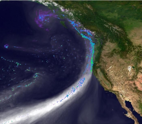
Image: Snapshot of the simulated landfall of an atmospheric river along the west coast of North America on February 11, 2020. Credit: DOE Office of Science, Energy Exascale Earth System Model (E3SM) project. (Credit: DOE Office of Science)


