
Sentinel-6B will measure sea surface height for nearly all of the world’s ocean, providing important data for information products, including weather and hurricane forecasts.
Sentinel-6B will measure sea surface height for nearly all of the world’s ocean, providing important data for information products, including weather and hurricane forecasts.
NASA has a long record of monitoring Earth’s sea surface height, information critical not only for tracking how the ocean changes over time but also for hurricane forecasting. These extreme storms can cost the United States billions of dollars each year, wreaking havoc on lives and property. Meteorologists have worked to improve forecasts for a hurricane’s path, or track, as well as its intensity, measured as surface wind speed. Sentinel-6B, the U.S.-European satellite launching later this year, will help in that effort.
The satellite is the second of two spacecraft that constitute the Sentinel-6/Jason-CS (Continuity of Service) mission, a collaboration between NASA, ESA (European Space Agency), EUMETSAT (the European Organisation for the Exploitation of Meteorological Satellites), and the U.S. National Oceanic and Atmospheric Administration (NOAA). With its launch planned for no earlier than Nov. 16, 2025, Sentinel-6B will take over from its twin, Sentinel-6 Michael Freilich, which launched in November 2020 as part of a long line of U.S.-European missions that have monitored sea levels since 1992.
Read More: NASA Jet Propulsion Laboratory
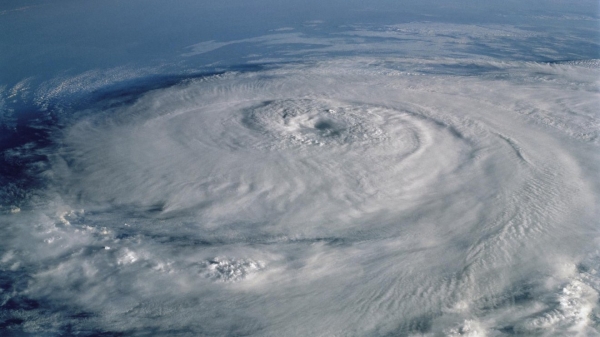
Sea surface height can tell meteorologists a lot about extreme storms like hurricanes, including whether they will intensify within a day. This kind of information can help communities better prepare if a hurricane is headed their way. Hurricane Elena is seen here from the space shuttle Discovery in 1985. (Photo Credit: NASA)


