
Researchers from the UCLA Samueli School of Engineering and their collaborators have developed FuelVision, a new system that could help enhance nationwide wildfire preparedness by combining satellite imagery with artificial intelligence to rapidly and accurately identify wildfire fuel sources.
Researchers from the UCLA Samueli School of Engineering and their collaborators have developed FuelVision, a new system that could help enhance nationwide wildfire preparedness by combining satellite imagery with artificial intelligence to rapidly and accurately identify wildfire fuel sources.
In validation tests using data from two of California’s most intense recent wildfires — the Dixie and Caldor fires of 2021 — FuelVision’s predictions closely matched actual fuel maps, demonstrating the tool’s potential for real-world use. The system achieved 77% mapping accuracy in the tests. A study describing the new system was recently published in the International Journal of Applied Earth Observation and Geoinformation.
“We’ve built a tool that lets anyone — from local agencies to global researchers — generate wildfire fuel maps using satellite data,” said Riyaaz Shaik, lead author of the study and a research scientist at UCLA. “That helps make vital wildfire risk information accessible for faster, smarter response.”
Although some models have achieved higher accuracy on large scales, they are slower and rely on expert analysis. In contrast, FuelVision operates autonomously, utilizing commonly available data.
Read More: University of California – Los Angeles
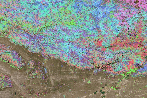
Image: Fuels map of the 2025 Eaton Fire, as predicted by FuelVision. (Credit: Riyaaz Shaik and Patrick Hadinata/UCLA)


