
As winter 2025 loosened its grip on the Southern Hemisphere, sea ice around Antarctica continued to spread across the ocean’s surface.
As winter 2025 loosened its grip on the Southern Hemisphere, sea ice around Antarctica continued to spread across the ocean’s surface. By September 17, it reached its maximum extent of the year, though that peak remained relatively low compared to levels observed before 2016.
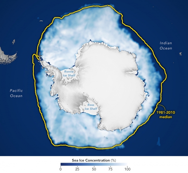
On that day, Antarctic sea ice covered 17.81 million square kilometers (6.88 million square miles). This marks the third-lowest maximum in the 47-year satellite record and falls about 900,000 square kilometers (348,000 square miles) below the 1981-2010 average.
This map shows the sea ice extent (white) on September 17 compared to the 1981-2010 average extent for the same day (yellow line). Scientists calculate sea ice extent by dividing the ocean into a grid and summing the area of squares that meet a specific concentration threshold—those that are at least 15 percent covered by ice.
Read More: NASA Earth Observatory
Image: NASA Earth Observatory images by Michala Garrison, using data from the National Snow and Ice Data Center.


