
As industry, infrastructure and society move into increasingly inaccessible and weather-prone areas, the risk and the need for accurate knowledge increase.
As industry, infrastructure and society move into increasingly inaccessible and weather-prone areas, the risk and the need for accurate knowledge increase.
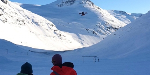
Many of the biggest challenges lie hidden below the surface – in snow, soil, ice and rock.
This is precisely where SINTEF deploys its drones with advanced sensors. They are equipped with radar, magnetics and cameras.
Read More at: Norwegian University of Science and Technology
This photo depicts researchers mapping the depth, moisture and risk levels in the snowpack at Fonnbu, NGI's research station on Strynefjellet in western Norway. This is one of the country’s most avalanche-prone areas. (Photo Credit: SINTEF)


