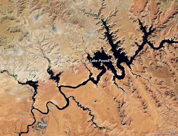
The effects of a meager mountain snowpack across the Upper Colorado Basin in winter 2025-2026 had made their way downstream to Lake Powell by summer.
The effects of a meager mountain snowpack across the Upper Colorado Basin in winter 2025-2026 had made their way downstream to Lake Powell by summer. After seasonal snowmelt declined to a relative trickle, the second-largest reservoir in the U.S. sat at record-low levels in late August and early September.
These images show a portion of Lake Powell just above Glen Canyon Dam as observed by the OLI (Operational Land Imager) on the NASA-USGS Landsat 8 satellite on September 1, 2017 (left), and September 10, 2026 (right). In the 2026 image, the water level stood at 3,517.24 feet. About a month prior, it had dipped below the previous record-low level of 3,519.92 feet, set on April 13, 2023, and continued to tick downward in early September. The 2017 image represents one of the highest water levels of the past decade.
The Colorado River feeds Lake Powell and then Lake Mead farther downstream, which also hit record-low levels in August 2026. Managed by the U.S. Bureau of Reclamation (USBR) and other agencies, the river provides water and electric power to more than 40 million people—including in Las Vegas, Phoenix, Los Angeles, and San Diego—and water to some 5 million acres of farmland in the Southwest.
Read More: NASA Earth Observatory
Image: Lake Powell at a record low on September 10, 2026. Images acquired with the OLI (Operational Land Imager) on Landsat 8. NASA Earth Observatory images by Lauren Dauphin.