Irrigation canals form a sort of circulatory system for global agriculture. Across the world, millions of kilometers of human-made canals carry water from lakes, rivers and reservoirs downhill to farmland.
Irrigation canals form a sort of circulatory system for global agriculture. Across the world, millions of kilometers of human-made canals carry water from lakes, rivers and reservoirs downhill to farmland. Canals are vitally important to human food production, yet many agricultural areas lack the means to monitor the ebb and flow of water through these waterways. This forces farmers and water managers to rely on scattered gauges, inspections and local reports to make decisions about water use.
A new study from the University of Washington suggests, however, that the tools needed for more comprehensive monitoring may already exist. In the study, researchers analyzed data from a NASA satellite built to track over time the water level of oceans, lakes, rivers and other large bodies of water. That project was never designed to track smaller bodies like canals. Yet, when the researchers looked at roughly 800,000 kilometers of canals in Asia, they found that the satellite could measure water levels with moderate to high confidence at more than 85% of locations.
The discovery could give farmers around the world a powerful new tool to manage precious water resources, prepare for droughts and improve food security in their communities.
Read More at: University of Washington
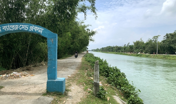
Irrigation canals, like this one in Bangladesh, supply vast amounts of water to farmland around the world. A new study from the UW shows that a NASA satellite originally built to monitor oceans and other large bodies of water can also track the ebb and flow of water through hundreds of thousands of kilometers of canals in Asia. (Photo Credit: Faisal Hossain)