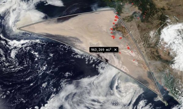
NOAA/NASA's Suomi NPP satellite captured these series of images (made into an animated GIF) showing the winds changing direction on Sep. 06, 2020 when choking clouds of brown smoke began to billow and cascade into the Pacific Ocean.
NOAA/NASA's Suomi NPP satellite captured these series of images (made into an animated GIF) showing the winds changing direction on Sep. 06, 2020 when choking clouds of brown smoke began to billow and cascade into the Pacific Ocean.

Infrared imagery from NASA’s Aqua satellite showed an elongated Tropical Storm Rene being battered by wind shear in the Central Atlantic Ocean.

A recent report confirms that ice sheets in Greenland and Antarctica, whose mass-loss rates have been rapidly increasing, are matching the Intergovernmental Panel on Climate Change's worst-case sea-level rise scenarios.

Wind shear was affecting both Tropical Storm Paulette and Rene in the Atlantic Ocean on Sept. 11.

On 19 August 2020, the world’s largest and longest polar research expedition – known as MOSAiC – reached the North Pole after making an unplanned detour owing to lighter-than-usual sea ice conditions.

In May of 2020, local geologists identified a steep, unstable slope that has the potential to become a tsunami-generating landslide in Barry Arm, a glacial fjord 60 miles east of Anchorage, Alaska.


