We may wish some memories could last a lifetime, but many physical and emotional factors can negatively impact our ability to retain information throughout life.

articles
Streetlights Contribute Less to Nighttime Light Emissions in Cities than Expected
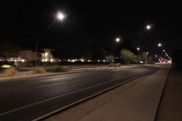
When satellites take pictures of Earth at night, how much of the light that they see comes from streetlights?
NASA Prepares for Hurricane Zeta
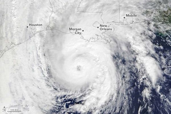
As Tropical Storm Zeta makes landfall on the U.S. Gulf Coast, NASA has eyes on the storm with an array of Earth-observing instruments and stands ready to aid affected communities with critical data and analysis.
Priming the Immune System to Attack Cancer
Immunotherapies, such as checkpoint inhibitor drugs, have made worlds of difference for the treatment of cancer.
Bridges With Limb-Inspired Architecture Could Withstand Earthquakes, Cut Repair Costs
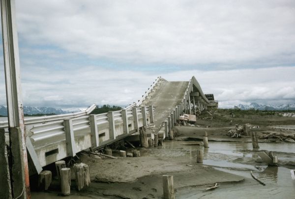
Texas A&M researchers are part of a team studying a promising column design strategy.
Hurricane Zeta Arrives on the Gulf Coast
It will be the fifth storm to hit Louisiana this year, and the eleventh to hit the continental United States.


