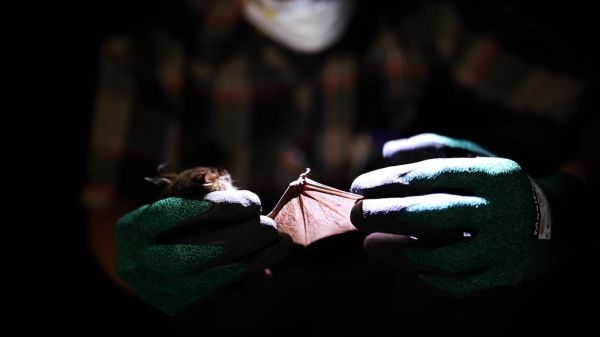
At night in a Ugandan forest, a team of American and African scientists take oral swabs from insect-eating cyclops leaf-nosed bats.

At night in a Ugandan forest, a team of American and African scientists take oral swabs from insect-eating cyclops leaf-nosed bats.
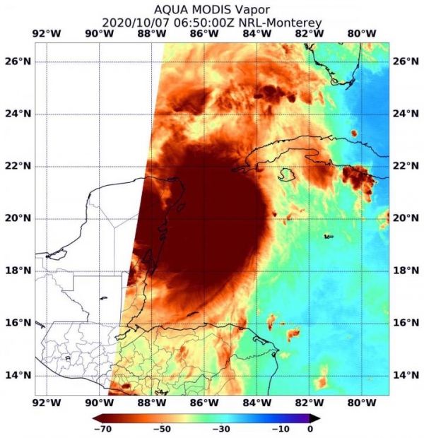
When NASA’s Aqua satellite passed over the Caribbean Sea on Oct. 7, it gathered water vapor data on Hurricane Delta as Mexico’s Yucatan continues to feel its effects.
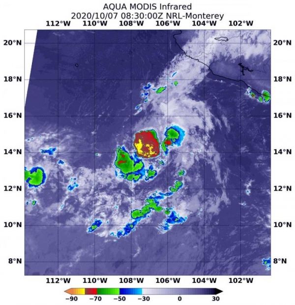
Infrared imagery from NASA’s Aqua satellite revealed that dry air is eroding Tropical Storm Norbert, located off the coast of southwestern Mexico.
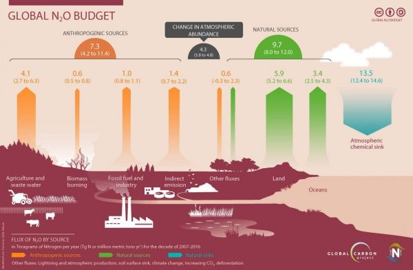
The growing use of nitrogen fertilizers in the production of food worldwide is increasing concentrations of nitrous oxide in the atmosphere—a greenhouse gas 300 times more potent than carbon dioxide and which remains in the atmosphere longer than a human lifetime.
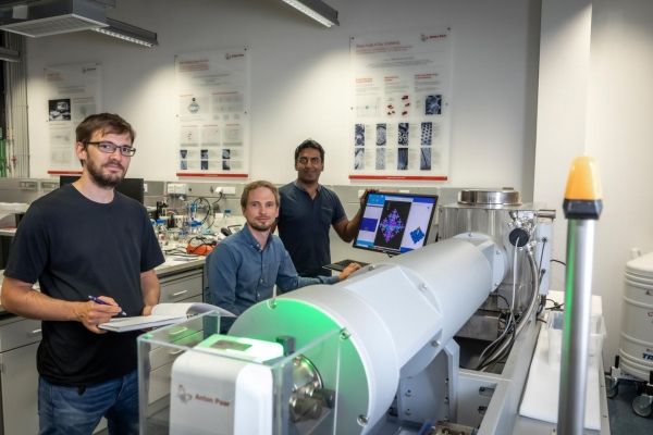
Limited safety, sustainability and recyclability are key drawbacks of today's lithium-ion battery technology, along with restricted availability of starting materials (e.g. cobalt).
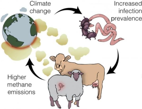
Climate change is affecting the spread and severity of infectious diseases around the world — and infectious diseases may in turn be contributing to climate change, according to a new paper published Oct. 7 in Trends in Ecology & Evolution.


