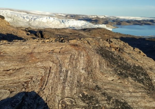
Ancient rocks from Greenland have shown that the elements necessary for the evolution of life did not come to Earth until very late in the planet’s formation – much later than previously thought.

Ancient rocks from Greenland have shown that the elements necessary for the evolution of life did not come to Earth until very late in the planet’s formation – much later than previously thought.
A study led by the University is published in Nature Communications and funded by the Natural Environment Research Council.

The report assesses that, by the end of January 2020, the impact of the desert locust on cereal production in Horn of Africa and South-Asia is limited.
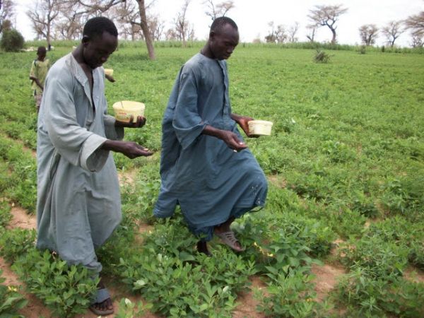
In Senegal, groundnut and maize are commonly contaminated with highly toxic, cancer-causing chemicals called aflatoxins, which are produced by fungi in the genus Aspergillus when they infect crops.

Scientists have discovered a possible link between Parkinson’s disease and a gene impacted by a neurotoxin found in blue-green algae.

Professor Kenneth Leung and his research team have been monitoring organotin pollution in the marine environment of Hong Kong since 2004.


