Cognitive impairment without dementia (CIND), or mild cognitive impairment, is a condition that affects your memory and may put you at risk for Alzheimer’s disease and dementia.

articles
McMaster Researcher Warns Plastic Pollution in the Great Lakes Is a Growing Concern to Ecosystems and Human Health

Research from a leading international expert on the health of the Great Lakes suggests that the growing intensity and scale of pollution from plastics poses serious risks to human health and will continue to have profound consequences on the ecosystem.
Researchers Reach Milestone in Quantum Standardization

Researchers at the University of Waterloo have developed a method that could pave the way to establishing universal standards for measuring the performance of quantum computers.
UC Develops Satellites That Fix Other Satellites

When satellites break, which is surprisingly often, there isn’t much you can do about them.
Unraveling the Venomous Bite of An Endangered Mammal
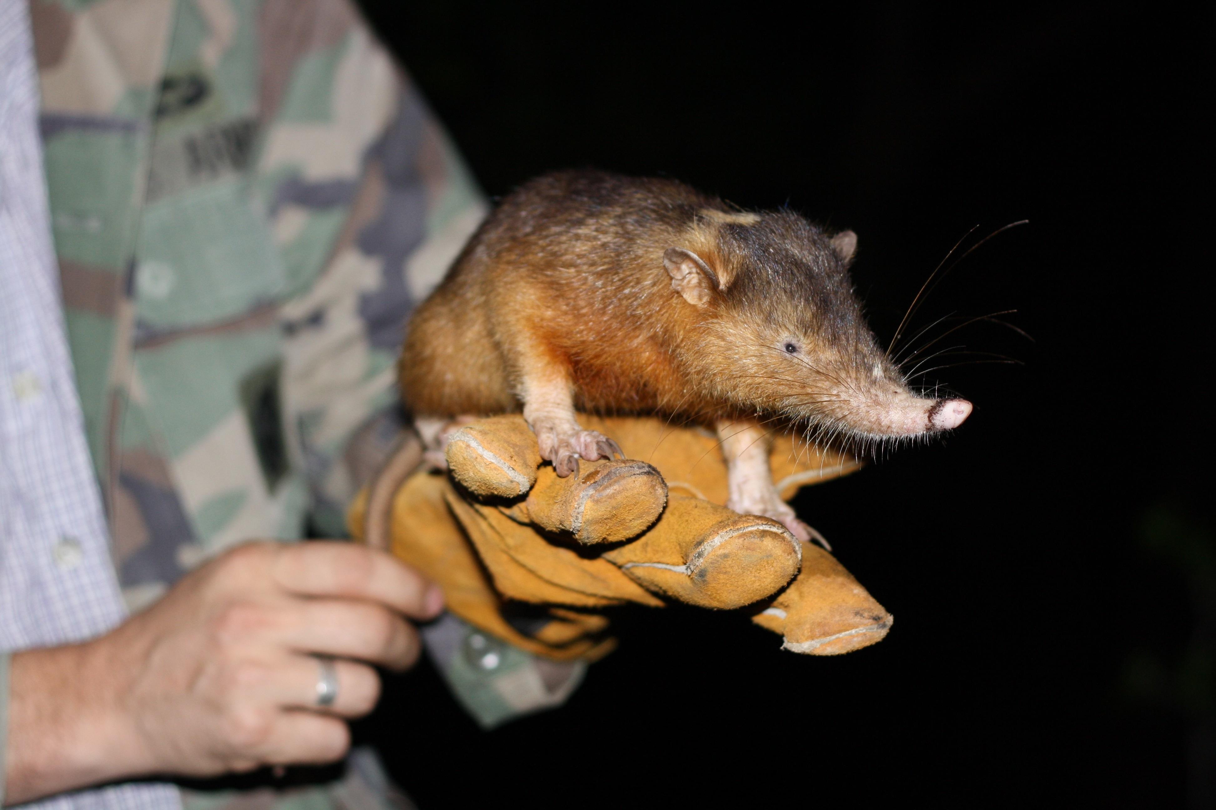
Researchers from Liverpool School of Tropical Medicine (LSTM) and Zoological Society of London (ZSL(link is external)) have worked with a team of scientists from institutions across the globe – to uncover the truth behind the origin of venom in some very unusual mammals.
Satellite Tracking Guam’s Tropical Storm Kammuri

The National Weather Service in Guam has posted warnings as Tropical Storm Kammuri lingers nearby.


