
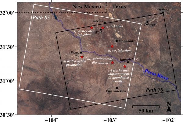
Analysis indicates decades of oil production activity have destabilized localities in an area of about 4,000 square miles populated by small towns, roadways and a vast network of oil and gas pipelines and storage tanks
Two giant sinkholes near Wink, Texas, may just be the tip of the iceberg, according to a new study that found alarming rates of new ground movement extending far beyond the infamous sinkholes.
That’s the finding of a geophysical team from Southern Methodist University, Dallas that previously reported the rapid rate at which the sinkholes are expanding and new ones forming.
Now the team has discovered that various locations in large portions of four Texas counties are also sinking and uplifting.
Radar satellite images show significant movement of the ground across localities in a 4000-square-mile area — in one place as much as 40 inches over the past two-and-a-half years, say the geophysicists.
Continue reading at Southern Methodist University
Image via Zhong Lu, SMU


