
Satellite imagery showed that Tropical Depression Jelawat was still dealing with southerly vertical wind shear that was pushing the bulk of its clouds north of its center.
On March 27, Jelawat was centered over 100 miles from Yap State in the Northwestern Pacific Ocean. Yap State is one of four states in the Federated States of Micronesia. The other states are Chuuk State, Kosrae State and Pohnpei State.
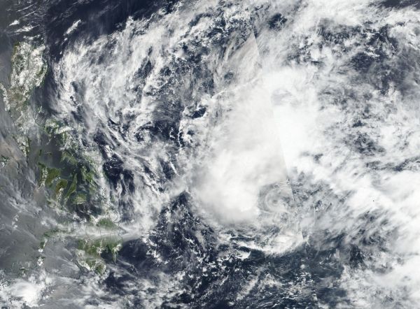
That day at 8 a.m. EST (1200 UTC), the Visible Infrared Imaging Radiometer Suite (VIIRS) instrument aboard NASA-NOAA's Suomi NPP satellite captured a visible image of Jelawat. The image showed that the bulk of the convection remains displaced to the north. That’s because the system is in an area of moderate vertical wind shear.
Read more at NASA / Goddard Space Flight Center
Image: On March 27 at 8 a.m. EST (1200 UTC) NASA-NOAA's Suomi NPP satellite captured a visible image of Jelawat that showed that the bulk of the convection displaced to the north.
Credits: NOAA / NASA Goddard Rapid Response Team


