
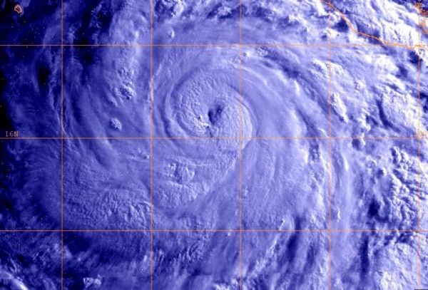
The second major hurricane of the Eastern Pacific Ocean season formed after the first hurricane, Aletta, weakened. NOAA's GOES-West satellite captured an image of Hurricane Bud on June 11.
The second major hurricane of the Eastern Pacific Ocean season formed after the first hurricane, Aletta, weakened. NOAA's GOES-West satellite captured an image of Hurricane Bud on June 11.
Hurricane Bud formed on Saturday, June 9 around 5 p.m. EDT as Tropical Depression Three-E. By 11 p.m. EDT that day, the storm strengthened into a tropical storm and was named Bud.
Bud formed close enough to southwestern Mexico to trigger a watch. The National Hurricane Center issued a Tropical Storm Watch from Manzanillo to Cabo Corrientes, Mexico.
The National Hurricane Center noted winds, heavy rain and dangerous ocean swells are likely. NHC said on June 11, "Bud is expected to produce total rain accumulations of 3 to 6 inches across much of southwestern Mexico, with isolated maximum amounts of 10 inches into Tuesday afternoon. These rains could cause life-threatening flash floods and mud slides. In addition, ocean swells generated by Bud will continue to affect portions of the coast of southwestern Mexico during the next few days. These swells are likely to cause life-threatening surf and rip current conditions. Tropical storm conditions are possible within the watch area beginning this afternoon, June 11.
Read more at NASA/Goddard Space Flight Center
Image: At 914 a.m. EDT (1314 UTC) on June 11, NOAA's GOES-West satellite captured an infrared image of Hurricane Bud in the Eastern Pacific Ocean. (Credit: NOAA/NRL)


