
NASA satellite imagery captured Tropical Storm 07W soon after it developed near Kadena Air Base on the island of Okinawa, Japan in the Northwestern Pacific Ocean.
NASA satellite imagery captured Tropical Storm 07W soon after it developed near Kadena Air Base on the island of Okinawa, Japan in the Northwestern Pacific Ocean.
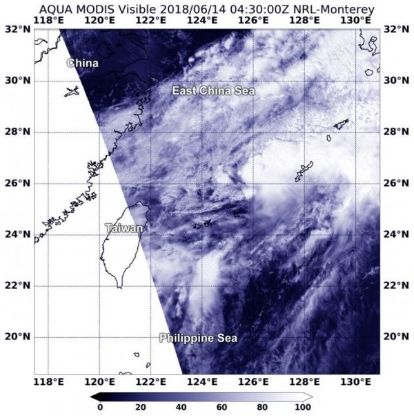
On June at 12:30 a.m. EDT (0430 UTC), the MODIS or Moderate Resolution Imaging Spectroradiometer instrument aboard NASA's Aqua satellite captured a visible light image of the storm. The image showed there is a small area of deep and persistent convection located to the northeast of the low level circulation center. As a result, the storm appeared elongated on the MODIS imagery. A METOP-B satellite image confirmed that the storm is asymmetric.
The Joint Typhoon Warning Center noted that the storm is elongated because it is being battered by strong vertical wind shear between 34 to 46 mph (30 to 40 knots/55 to 74 kph).
Read more at NASA/Goddard Space Flight Center
Image: On June 14 at 12:30 a.m. EDT (0430 UTC), the MODIS instrument aboard NASA's Aqua satellite captured a visible light image of Tropical Storm 07W.The storm appears asymmetric because it is being battered by strong wind shear. (Credit: NASA)


