
If you can predict the path of the jet stream, the upper atmosphere’s undulating river of wind, then you can predict weather – not just for a week or two, but for an entire season. A new Stanford study moves toward that level of foresight by revealing a physical link between the speed and location of the jet stream and the strength of the polar vortex, a swirl of air that usually hovers over the Arctic.
If you can predict the path of the jet stream, the upper atmosphere’s undulating river of wind, then you can predict weather – not just for a week or two, but for an entire season. A new Stanford study moves toward that level of foresight by revealing a physical link between the speed and location of the jet stream and the strength of the polar vortex, a swirl of air that usually hovers over the Arctic.
“The jet stream sets everything,” said Aditi Sheshadri, lead author and assistant professor of Earth System Science in the School of Earth, Energy, & Environmental Sciences (Stanford Earth). “Storms ride along it. They interact with it. If the jet stream shifts, the place where the storms are strongest will also shift.”
The research, published in the Journal of Atmospheric Sciences, identifies two distinct modes in how air flows within the jet stream and the layers of atmosphere that sandwich it.
The atmosphere’s deep system
In one mode, changes in wind speed and direction start close to the equator in the troposphere, the wet, stormy layer of atmosphere below the jet stream and closest to Earth’s surface. Shifts of wind in this mode quickly propagate up through the jet stream and into the polar vortex in the dry, upper layer of atmosphere known as the stratosphere.
Read more at Stanford University
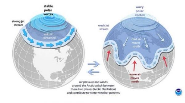
Image: The science behind the polar vortex. (Credit: NOAA)


