
NASA-NOAA's Suomi NPP satellite caught up with Typhoon Leepi in the open waters of the Northwestern Pacific Ocean and captured a visible image that showed the bulk of clouds were northeast of the center.
NASA-NOAA's Suomi NPP satellite caught up with Typhoon Leepi in the open waters of the Northwestern Pacific Ocean and captured a visible image that showed the bulk of clouds were northeast of the center.
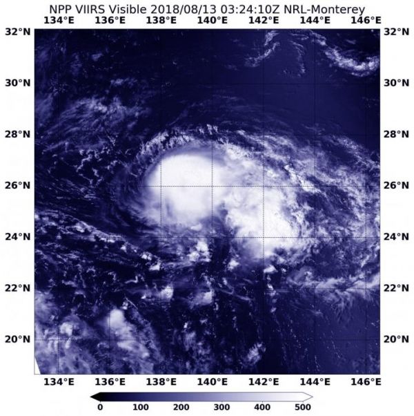
Leepi developed early on Aug. 11 as tropical depression 19W. Over the weekend of Aug. 11 and 12 it strengthened into a tropical storm.
On August 13 at 0324 UTC (Aug. 12 at 11:24 p.m. EDT) the Visible Infrared Imaging Radiometer Suite (VIIRS) instrument aboard NASA-NOAA's Suomi NPP satellite captured visible image of Leepi. The image showed powerful thunderstorms circling the low-level center of circulation and extending in a band northeast of the center. The storm appeared to be degrading from the previous day's satellite imagery.
Read more at NASA/Goddard Space Flight Center
Image: On Aug. 13 at 0324 UTC (Aug. 12 at 11:24 p.m. EDT) the VIIRS instrument aboard NASA-NOAA's Suomi NPP satellite captured a visible image of Tropical Storm Leepi. (Credit: NOAA/NASA/NRL)


