
NASA’s Aqua satellite saw the sixteenth tropical depression of the Eastern Pacific Ocean come together on Aug. 28.
NASA’s Aqua satellite saw the sixteenth tropical depression of the Eastern Pacific Ocean come together on Aug. 28.
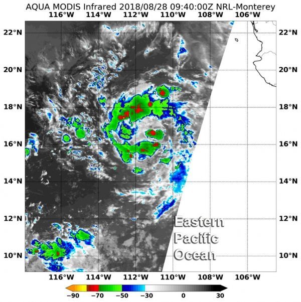
At 5:40 a.m. EDT (0940 UTC) on Aug. 28 the Moderate Resolution Imaging Spectroradiometer or MODIS instrument aboard Aqua used infrared data to measure cloud top temperatures in Tropical Depression 16E (TD16E) when it was forming.
Coldest cloud tops were near minus 70 degrees Fahrenheit (minus 56.6 degrees Celsius). Aqua observed fragmented bands of thunderstorms circling a low-level center of circulation and some stronger storms within them.
Storms with cloud top temperatures that cold have the capability to produce heavy rainfall. That heavy rain was falling over open ocean waters.
Read more at NASA / Goddard Space Flight Center
Image: At 5:40 a.m. EDT (0940 UTC) on Aug. 28, the MODIS instrument aboard NASA’s Aqua satellite found coldest cloud tops (red) were near minus 70 degrees Fahrenheit (minus 56.6 degrees Celsius) were in fragmented storms within Tropical Depression 16E. CREDIT: NASA / NRL


