
Hurricane Olivia’s eye was clear in infrared imagery taken by NASA’s Aqua satellite from its orbit in space.
Hurricane Olivia’s eye was clear in infrared imagery taken by NASA’s Aqua satellite from its orbit in space.
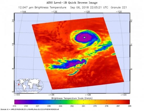
Infrared satellite data at 4:50 p.m. EDT (2205 UTC) on Sept. 6, from the instrument aboard NASA’s Aqua satellite showed a clear image of Hurricane Olivia’s eye surrounded by coldest cloud top temperatures near minus 63 degrees Fahrenheit (minus 53 degrees Celsius). NASA research has found that cloud top temperatures that cold have the capability to generate heavy rainfall.
On Sept.7, Olivia’s overall cloud structure in infrared and passive microwave satellite imagery has changed little since the previous advisory, except that the cloud tops have warmed significantly around the well-defined, 20-nautical-mile in diameter eye.
Read more at NASA/Goddard Space Flight Center
Image: At 4:50 p.m. EDT (2205 UTC) on Sept. 6, the AIRS instrument aboard NASA's Aqua satellite looked at Hurricane Olivia in infrared light. AIRS found coldest cloud tops ( had temperatures near minus 63 degrees Fahrenheit (minus 53 degrees Celsius). (Credit: NASA/NRL)


