
NASA’s Aqua satellite obtained a visible image of Hurricane Norman northeast of the Hawaiian Islands and found the storm weakening and battling wind shear.
NASA’s Aqua satellite obtained a visible image of Hurricane Norman northeast of the Hawaiian Islands and found the storm weakening and battling wind shear.
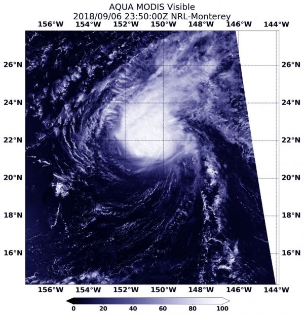
NASA’s Aqua satellite provided an infrared look at Norman as it continued weakening and moving northwest of the Hawaiian Islands. It is not close enough to the islands to generate any watches or warnings, however, a large swell generated by Norman peaked across the main Hawaiian Islands overnight on Sept. 6, causing large and potentially dangerous surf along east facing shores. The surf is forecast to diminish on Friday, Sept. 7.
The Aqua satellite image taken from the MODIS instrument showed the storm was being tilted from strong vertical wind shear. The eye was covered by clouds which made the center difficult to locate.
Read more at NASA / Goddard Space Flight Center
Image: At 7:50 p.m. EDT (2350 UTC) on Sept. 6, the MODIS instrument aboard NASA’s Aqua satellite looked at Hurricane Norman in visible light. CREDITS: NASA / NRL


