
NASA-NOAA’s Suomi NPP satellite passed over the eye of Hurricane Helene in the eastern Atlantic.
NASA-NOAA’s Suomi NPP satellite passed over the eye of Hurricane Helene in the eastern Atlantic.
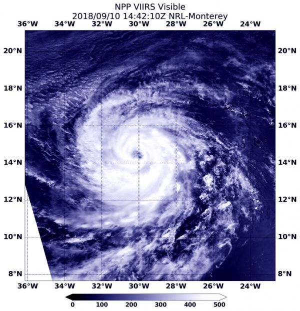
On Sept. 10 at 10:42 a.m. EDT (1442 UTC) the Visible Infrared Imaging Radiometer Suite (VIIRS) instrument aboard NASA-NOAA’s Suomi NPP satellite captured visible image of Hurricane Helene. VIIRS imagery showed the eye was about 20 nautical miles wide.
The next day, Sept. 11, NOAA’s National Hurricane Center noted another satellite image of Helene showed a well-developed closed eyewall and strong band of thunderstorms with cold cloud tops of minus 104 degrees Fahrenheit/minus 76 degrees Celsius (indicating very strong storms) wrapping around the south through east quadrants of the cyclone.
Read more at NASA/Goddard Space Flight Center
Image: On Sept. 10 at 10:42 a.m. EDT (1442 UTC) the VIIRS instrument aboard NASA-NOAA’s Suomi NPP satellite captured a visible image of Hurricane Helene. (Credit: NOAA/NASA/NRL)


