
NASA’s Aqua satellite provided an infrared look at Tropical Depression Paul and found its center pushed away from strongest storms.
NASA’s Aqua satellite provided an infrared look at Tropical Depression Paul and found its center pushed away from strongest storms.
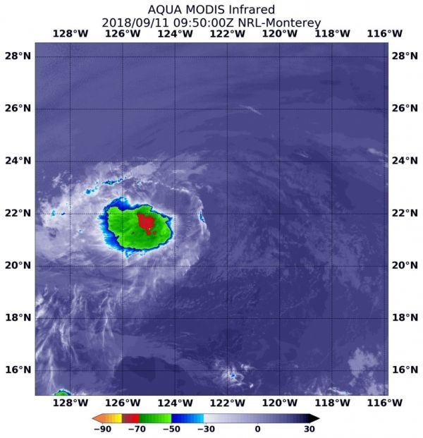
At 5:50 a.m. EDT (0950 UTC) on Sept. 11, from the Moderate Resolution Imaging Spectroradiometer or MODIS instrument aboard NASA’s Aqua satellite revealed a small area of strongest storms in Paul. Those storms, pushed west of the center of circulation, had cloud tops with temperatures near minus 70 degrees Fahrenheit (minus 56.6 degrees Celsius). NASA research has found that cloud top temperatures that cold have the capability to generate heavy rainfall.
NOAA’s National Hurricane Center (NHC) said “The center of Paul remains to the east of a small area of deep convection.”
Read more at NASA/Goddard Space Flight Center
Image: At 5:50 a.m. EDT (0950 UTC) on Sept. 11, the MODIS instrument aboard NASA’s Aqua satellite looked at Tropical Depression Paul infrared light. MODIS found a small area of coldest cloud tops (red) had temperatures near minus 70 degrees Fahrenheit (minus 56.6 degrees Celsius). (Credit: NASA/NRL)


