
Typhoon Mangkhut had already strengthened into a Super Typhoon when NASA-NOAA’s Suomi NPP satellite grabbed a visible image of the storm in the Northwestern Pacific Ocean on Sept. 11. It is forecast to intensify even more.
Typhoon Mangkhut had already strengthened into a Super Typhoon when NASA-NOAA’s Suomi NPP satellite grabbed a visible image of the storm in the Northwestern Pacific Ocean on Sept. 11. It is forecast to intensify even more.
Fortunately, Mangkhut has moved away from the Marianas Islands and is moving over open ocean so there are no watches or warnings in effect.
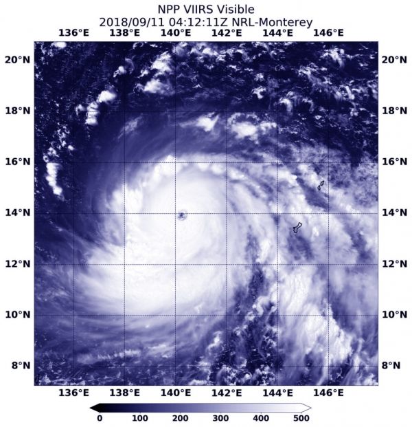
On Sept. 11 at 12:12 a.m. EDT (0412 UTC) the Visible Infrared Imaging Radiometer Suite (VIIRS) instrument aboard NASA-NOAA’s Suomi NPP satellite captured visible image of Super Typhoon Mangkhut. The image showed a clear eye surrounded by bands of powerful thunderstorms.
Read more at NASA / Goddard Space Flight Center
Image: On Sept. 11 at 12:12 a.m. EDT (0412 UTC) the VIIRS instrument aboard NASA-NOAA’s Suomi NPP satellite captured a visible image of Super Typhoon Mangkhut moving through the Northwestern Pacific Ocean. CREDIT: NOAA / NASA / NRL


