
Hurricane response crews from the U.S. Geological Survey are installing storm-tide sensors at key locations along the North and South Carolina coasts in advance of Hurricane Florence.
Hurricane response crews from the U.S. Geological Survey are installing storm-tide sensors at key locations along the North and South Carolina coasts in advance of Hurricane Florence. Under a mission assignment from the Federal Emergency Management Agency, the USGS plans to deploy about 160 sensors and is consulting with federal and state partners about the need for similar equipment for other areas along the mid-Atlantic coast.
Storm surge is among the most dangerous natural hazards unleashed by hurricanes, with the capacity to destroy homes and businesses, wipe out roads, bridges, water and sewer systems, and profoundly alter coastal landscapes. The USGS has experts on these hazards, state-of-the-science computer models for forecasting coastal change, and sophisticated equipment for monitoring actual flood and tide conditions.
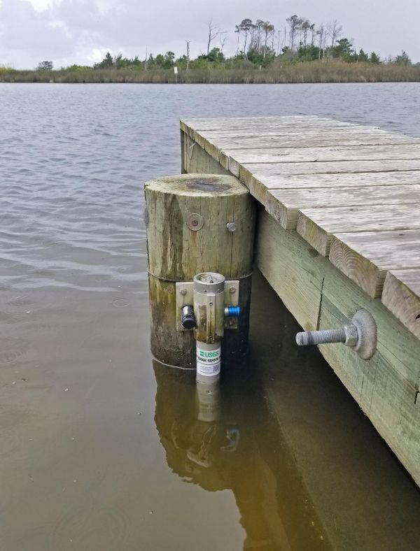
The sensors being installed to measure Hurricane Florence’s storm tide are housed in vented steel pipes a few inches wide and about a foot long. They are being installed on bridges, piers, and other structures that have a good chance of surviving the storm. The information the sensors collect will help define the depth and duration of a storm surge, as well as the time of its arrival and retreat. That information will help public officials assess storm damage, discern between wind and flood damage, and improve computer models used to forecast future floods. Information on the storm-tide sensor deployment and the incoming data will be available on the USGS “Flood Event Viewer” at https://stn.wim.usgs.gov/FEV/#FlorenceSep2018.
Continue reading at USGS.
Image via USGS.


