
NASA provided an infrared look at newly developed Tropical Storm Rosa in the Eastern Pacific and found the storm was getting better organized.
NASA provided an infrared look at newly developed Tropical Storm Rosa in the Eastern Pacific and found the storm was getting better organized.
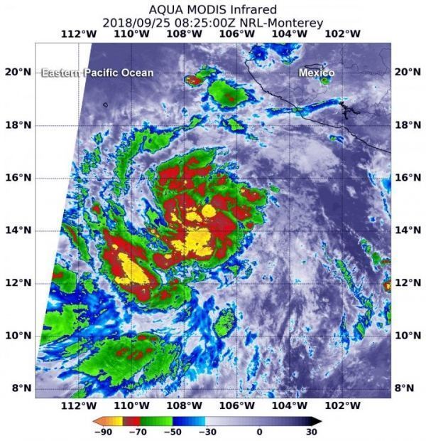
NASA’s Aqua satellite passed over the Eastern Pacific early on Sept. 25 when Rosa was still a tropical depression called 20E. Infrared satellite data taken at 4:25 a.m. EDT (0825 UTC) on Sept. 25 from the Moderate Resolution Imaging Spectroradiometer or MODIS instrument aboard NASA’s Aqua satellite revealed strongest storms with the coldest cloud top temperatures around 20E’s center and in a band of thunderstorms southwest of center.
MODIS data showed that the tropical cyclone’s cloud pattern has become better organized, with developing convective banding features and the depression was upgraded to a tropical storm.
Read more at NASA/Goddard Space Flight Center
Image: At 4:25 a.m. EDT (0825 UTC) on Sept. 25, 2018, the MODIS instrument aboard NASA's Aqua satellite looked at Tropical Depression 20E in infrared light. MODIS found coldest cloud tops (yellow) had temperatures near minus 80 degrees Fahrenheit (minus 62.2 degrees Celsius) around the center and southwest of the center. It later became Tropical Storm Rosa. (Credit: NASA/NRL)


