
Arctic sea ice likely reached its 2018 lowest extent on Sept. 19 and again on Sept. 23, according to NASA and the NASA-supported National Snow and Ice Data Center (NSIDC) at the University of Colorado Boulder. Analysis of satellite data by NSIDC and NASA showed that, at 1.77 million square miles (4.59 million square kilometers), 2018 effectively tied with 2008 and 2010 for the sixth lowest summertime minimum extent in the satellite record.
Arctic sea ice likely reached its 2018 lowest extent on Sept. 19 and again on Sept. 23, according to NASA and the NASA-supported National Snow and Ice Data Center (NSIDC) at the University of Colorado Boulder. Analysis of satellite data by NSIDC and NASA showed that, at 1.77 million square miles (4.59 million square kilometers), 2018 effectively tied with 2008 and 2010 for the sixth lowest summertime minimum extent in the satellite record.
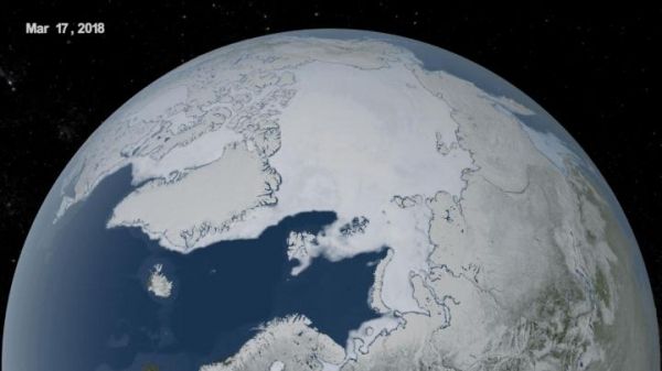
Arctic sea ice, the cap of frozen seawater blanketing most of the Arctic Ocean and neighboring seas in wintertime, follows seasonal patterns of growth and decay. It thickens and spreads during the fall and winter and thins and shrinks during the spring and summer. But in the past decades, increasing temperatures have led to prominent decreases in the Arctic sea ice extents, with particularly rapid decreases in the minimum summertime extent. The shrinking of the Arctic sea ice cover can ultimately affect the planet’s weather patterns and the circulation of the oceans.
“This year’s minimum is relatively high compared to the record low extent we saw in 2012, but it is still low compared to what it used to be in the 1970s, 1980s and even the 1990s,” said Claire Parkinson, a climate change senior scientist at NASA’s Goddard Space Flight Center in Greenbelt, Maryland.
Parkinson and her colleague Nick DiGirolamo calculated that, since the late 1970s, the Arctic sea ice extent has shrunk on average about 21,000 square miles (54,000 square kilometers) with each passing year. That is equivalent to losing a chunk of sea ice the size of Maryland and New Jersey combined every year for the past four decades.
Read more at NASA/Goddard Space Flight Center
Image: The yearly minimum Arctic sea ice extent has been decreasing at a rapid pace since the late 1970s due to warming temperatures. The twelve lowest extents in the satellite era have all occurred in the last twelve years. (Credit: National Snow and Ice Data Center (NSIDC) at the University of Colorado Boulder)


