
NASA’s Terra satellite passed over the Eastern Pacific Ocean and provided forecasters with a visible image of Hurricane Rosa that gave an indication an eye has formed. Rosa is expected to become a major hurricane by Thursday, Sept. 27.
NASA’s Terra satellite passed over the Eastern Pacific Ocean and provided forecasters with a visible image of Hurricane Rosa that gave an indication an eye has formed. Rosa is expected to become a major hurricane by Thursday, Sept. 27.
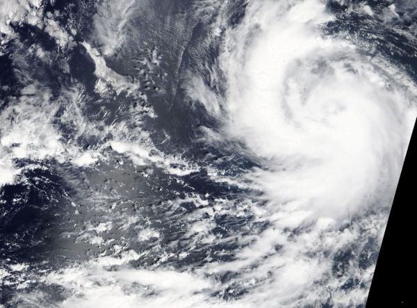
On Sept. 26 at 4:30 p.m. EDT (1630 UTC), the Moderate Resolution Imaging Spectroradiometer or MODIS instrument aboard NASA’s Terra satellite captured a visible image of Rosa. The image showed what appears to be a cloud filled-eye surrounded by bands of thunderstorms. Two thick bands of thunderstorms were wrapping into the center from the west and south.
The National Hurricane Center or NHC noted “Conventional satellite imagery show a large area of cold cloud tops near the center, and there is a hint of an eye in the first-light visible images. Microwave imagery indicates that the eye structure underneath the overcast has become better defined, with less evidence of dry air entrainment than seen yesterday.”
Read more at NASA/Goddard Space Flight Center
Image: On Sept. 26, 2018 at 4:30 p.m. EDT (1630 UTC), the MODIS instrument aboard NASA's Terra satellite captured a visible image of Hurricane Rosa. (Credit: NASA Worldview, Earth Observing System Data and Information System (EOSDIS))


