
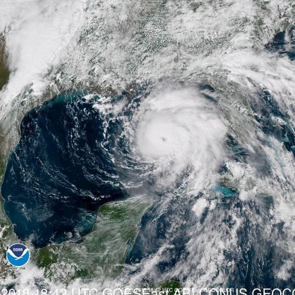
Michael introduced itself to North America with 155-mile-per-hour gusts of wind and a barometric pressure of 919 millibars, the third-strongest hurricane to ever make continental US landfall. It was a monster, and it stayed a monster as it rolled through Georgia and then on toward the Carolinas.
Michael introduced itself to North America with 155-mile-per-hour gusts of wind and a barometric pressure of 919 millibars, the third-strongest hurricane to ever make continental US landfall. It was a monster, and it stayed a monster as it rolled through Georgia and then on toward the Carolinas.
And monsters are made, not born. “The most striking thing about Michael is that it was barely a tropical storm a couple of days ago, and all of a sudden it almost touched cat-5 intensity,” says Karthik Balaguru, an oceanographer who studies hurricanes at the Pacific Northwest National Laboratory. Typically hurricanes ramp up more slowly (if at all), and landfall reduces their intensity. “The thing with Michael is, it just kept on intensifying,” Balaguru says.
That’s called—perhaps as you’d expect—rapid intensification, and it used to be a rare phenomenon among Atlantic hurricanes. That’s good, because rapidly intensifying hurricanes also tend to be the ones that are the most dangerous, the deadliest and the most expensive. Unfortunately, rapidly intensifying hurricanes seem to be a rarity no longer.
Read more at Wired
Image: Satellite image of Hurricane Michael, which is expected to make landfall on Oct. 10, 2018. (Credit: NOAA)


