
Hurricane Florence’s floodwaters and Hurricane Michael’s storm surge caused obvious devastation to natural areas, but a subtler set of harms is harder to see.
Hurricane Florence’s floodwaters and Hurricane Michael’s storm surge caused obvious devastation to natural areas, but a subtler set of harms is harder to see. Potentially destructive nonnative aquatic species, such as fast-growing plants that can choke waterways and hungry snails that can attack crops, can fan out across the landscape in the storms’ waters, spreading unseen and becoming hard to eradicate.
To help land managers find and manage these flood-borne newcomers before they get established, scientists at the U.S. Geological Survey have created two preliminary online maps, one for each hurricane. These early “storm tracker” map sets show that more than 160 nonnative aquatic plant and animal species had the potential to spread during the 2018 hurricane season. The maps are available at https://nas.er.usgs.gov/viewer/Flooding/.
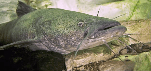
Flathead catfish seen underwater from front
Nationwide, more than 1,280 freshwater aquatic species have been reported as found beyond their home ranges. Some have caused no obvious ill effects on their new habitats. Others, like the zebra mussels introduced into the Great Lakes, have caused damage to fisheries, shipping, water utilities and other industries.
Storm surges and floodwaters can quickly spread nonnative aquatic species into waterways where they weren’t found before. The USGS’ innovative storm tracker maps were first produced in 2017 after Hurricane Harvey made landfall on Texas’ Gulf Coast, and became a useful tool for land managers. Scientists with the USGS Nonindigenous Aquatic Species Program have made six storm trackers so far: four for 2017 hurricanes Harvey, Irma, Maria and Nate, and the preliminary trackers for 2018 hurricanes Florence and Michael.
Continue reading at USGS.
Image via USGS.


