
Tropical Cyclone Funani continued tracking southeast through the Southern Indian Ocean on Feb. 7, 2019.
Tropical Cyclone Funani continued tracking southeast through the Southern Indian Ocean on Feb. 7, 2019. When the GPM satellite passed overhead, it revealed that Funani’s strongest rains wrapped around the center and extended northwest.
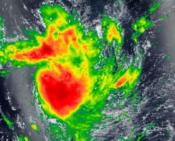
The Global Precipitation Measurement mission, or GPM, core satellite passed over Tropical Cyclone Funani on Feb. 8. GPM found the heaviest rainfall around the center and a fragmented band of thunderstorms northwest of center. In both areas rain was falling at a rate between 10 and 13 mm (0.4 and 0.5 inches) per hour. GPM is a joint mission between NASA and the Japan Aerospace Exploration Agency, JAXA.
Read more at NASA / Goddard Space Flight Center
Image: The GPM core satellite passed over Tropical Cyclone Funani on Feb. 8, 2019. GPM found the heaviest rainfall (red) was around the center and a fragmented band of thunderstorms northwest of center. In both areas rain was falling at a rate between 10 and 13 mm (0.4 and 0.5 inches) per hour. CREDIT: NASA Worldview, Earth Observing System Data and Information System (EOSDIS), JAXA


