
NASA’s Aqua satellite passed over the Southern Indian Ocean and captured an infrared image of Tropical Cyclone Gelena that revealed strongest storms were northwest of the eye.
NASA’s Aqua satellite passed over the Southern Indian Ocean and captured an infrared image of Tropical Cyclone Gelena that revealed strongest storms were northwest of the eye.
On Feb. 8, a tropical cyclone warning class 2 is in force at Mauritius and Rodrigues.
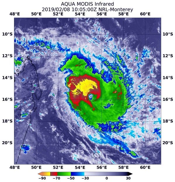
At 5:05 a.m. EST (1005 UTC) on Feb. 8 the MODIS instrument that flies aboard NASA’s Aqua satellite gathered infrared data on Tropical Cyclone Gelena. Infrared data provides temperature information. MODIS found coldest cloud top temperatures as cold as minus 80 degrees Fahrenheit (minus 62 Celsius) in storms in the northwestern quadrant, outside of the eye. NASA research has shown that cloud tops with temperatures that cold were high in the troposphere and have the ability to generate heavy rain.
Read more at NASA / Goddard Space Flight Center
Image: At 5:05 a.m. EST (1005 UTC) on Feb. 8, the MODIS instrument that flies aboard NASA’s Aqua satellite gathered infrared data on Tropical Cyclone Gelena. Strongest thunderstorms were in the northwestern quadrant of the storm, where cloud top temperatures were as cold as minus 80 degrees Fahrenheit (minus 62 Celsius) and appear in yellow in this false colored image. CREDIT: NASA / NRL


