
Tropical Cyclone Oma continued to move southeast in the Southern Pacific Ocean, and continue affecting Vanuatu. NASA-NOAA’s Suomi NPP satellite provided a visible image of the storm.
Tropical Cyclone Oma continued to move southeast in the Southern Pacific Ocean, and continue affecting Vanuatu. NASA-NOAA’s Suomi NPP satellite provided a visible image of the storm.
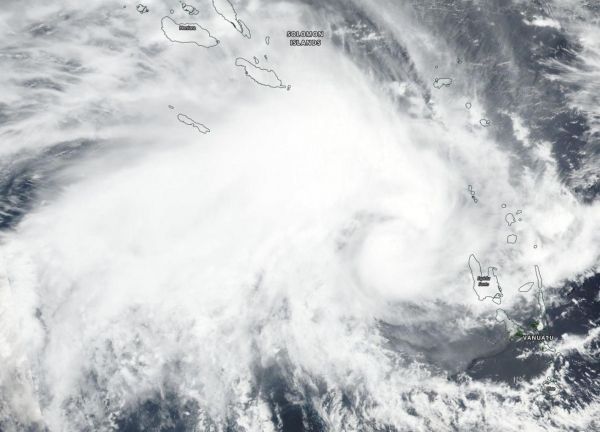
Suomi NPP passed over Oma on Feb. 13 and the Visible Infrared Imaging Radiometer Suite (VIIRS) instrument provided a visible image of the storm. The VIIRS image showed a circular center of thunderstorms with a large, wide band of thunderstorms wrapping into the center from the northwest. That’s because the storm is experiencing easterly winds that are pushing clouds west and away from the center. The image also showed the southeastern quadrant already over Espiritu Santu, Vanuatu.
The Joint Typhoon Warning Center (JTWC) noted on Feb. 13 at 4 a.m. EDT (0900 UTC) that Oma was near 14.6 degrees south latitude and 165.2 east longitude, about 262 nautical miles northwest of Port Vila, Vanuatu. Maximum sustained winds were near 45 knots (52 mph/83 kph). Oma was moving to the west-southwest.
Read more at NASA/Goddard Space Flight Center
Image: NASA-NOAA's Suomi NPP satellite passed over the Southern Pacific Ocean and captured a visible image of Tropical Cyclone Oma on Feb. 13 as it approached Vanuatu. (Credit: NASA Worldview, EARTH Observing System Data and Information System (EOSDIS))


