
Tropical Cyclone Gelena is being battered by outside winds, and that’s weakening the storm.
Tropical Cyclone Gelena is being battered by outside winds, and that’s weakening the storm. Visible imagery from NASA’s Aqua satellite revealed the bulk of clouds in Tropical Cyclone Gelena were pushed away from the center.
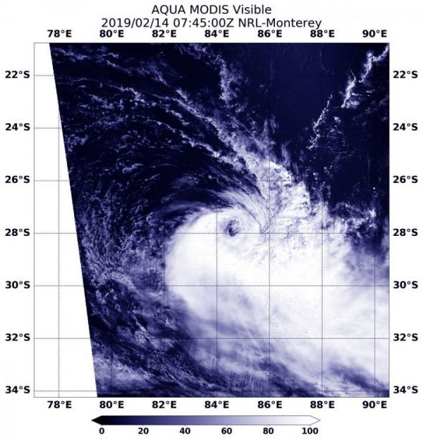
On Feb. 14, 2019 at 2:45 a.m. EDT (0745 UTC) the Moderate Resolution Imaging Spectroradiometer or MODIS instrument aboard NASA’s Aqua satellite captured a visible image of Tropical Cyclone Gelena in the Southern Indian Ocean. The image showed Gelena’s clear low level center of circulation, and the bulk of the tropical cyclone’s clouds pushed south of the center. That’s because of strong northerly wind shear.
In general, wind shear is a measure of how the speed and direction of winds change with altitude. Wind shear can tear a tropical cyclone apart or weaken it.
Read more at NASA/Goddard Space Flight Center
Image: On Feb. 14, 2019 at 2:45 a.m. EDT (0745 UTC) the MODIS instrument aboard NASA's Aqua satellite captured a visible light image of Tropical Cyclone Gelena being battered by wind shear in the Southern Indian Ocean. (Credit: NASA/NRL)


